China has begun doing to the United States in the Middle East, what the United States has been doing to Russia in Ukraine: Providing imagery of US bases, planes, troop concentrations and more so Iran can use them against the United States, the same way Ukraine uses US-provided info against Russia.
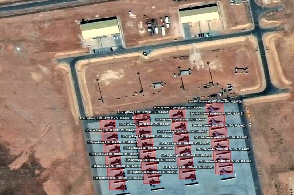
Not only is the satellite imagery clear, they overlaid identification tags showing "F-35" or "E-18 Growler" as seen in one image, below:
China has done this TODAY for several key US military sites in the Middle East:
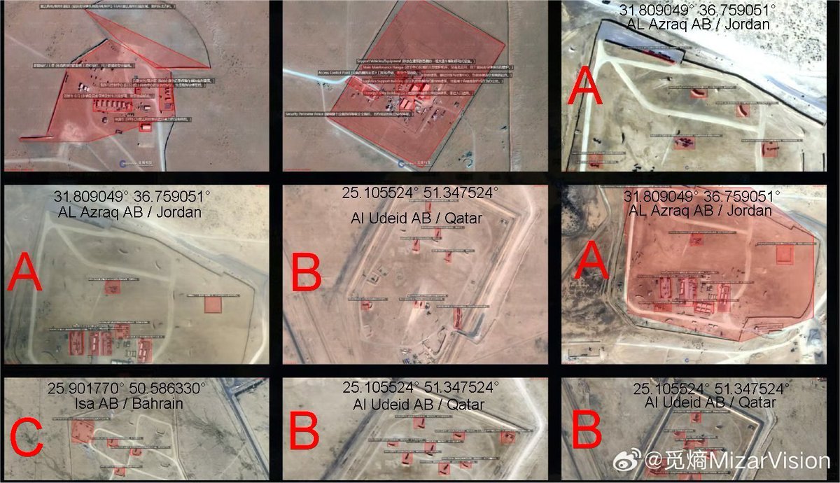
Notice, too, that the Images contain the precise GPS Coordinates, which can be used by Iran to target missile strikes.
Betrayed by the British, AGAIN
The United States this morning has been betrayed by the British. The UK has blocked U.S. use of RAF Fairford and Diego Garcia for Iran strikes, citing international law, leading Trump to withdraw support for Starmer's £35B Chagos Islands handover deal with Mauritius. Senior UK officials privately called the situation 'bleak.' - The Times
Friendly reminder the UK did the same exact thing June 18th 2025 4 days before the strikes on Iran and then said on June 22nd the day of the strikes they had not received any or request from the United States.