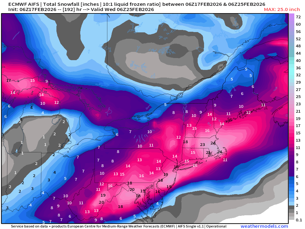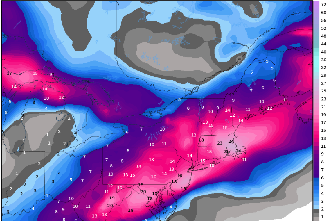
The Weather Service MODELS are forecasting a Nor'Easter with "Blizzard-like conditions" striking Sunday-into-Monday-into-Tuesday from New Jersey up through New York City, then northward toward Boston. Forecasting sixteen inches snow in NYC.
A major storm is likely to develop out of the Southeast U.S. and emerge off the Mid-Atlantic and either head (1) East out to Sea or (2) snuggle up nicely off New England and pound the I-95 corridor into submission (with snow)
Current trends with AIFS and GFS —> major impacts, while the ECMWF IFS has been flip-flopping back and forth with 06z closer to the coast. This system is in the 5 to 6 day time frame, so predictability of the track should be pretty good into tomorrow — meaning we can either lock-in a blizzard or send it off to sea. I’m favoring the AIFS since it incorporates the model bias intrinsically when it generates new forecast simulations.
AIFS has 18” to 24” for every big city from D.C. to Philly to NYC and Boston. Clean sweep — grand slam “blockbuster blizzard”
This is just a computer MODEL. It can be wrong. It can change. We'll have better info as we get closer, but this is a "Heads-up" for folks in the US Northeast.