I woke up at about 7:00 AM today, Sunday, Feb 22. It is lightly raining in the NYC area but the Weather Service has INCREASED the snowfall total, and narrowed the BLIZZARD WARNING, to __my__ area of New Jersey.
As of 7:40 AM, it is 36°F and still raining, but we can see some slushy sleet-like aspects to it. The temperature is dropping slowly. Little to no wind.
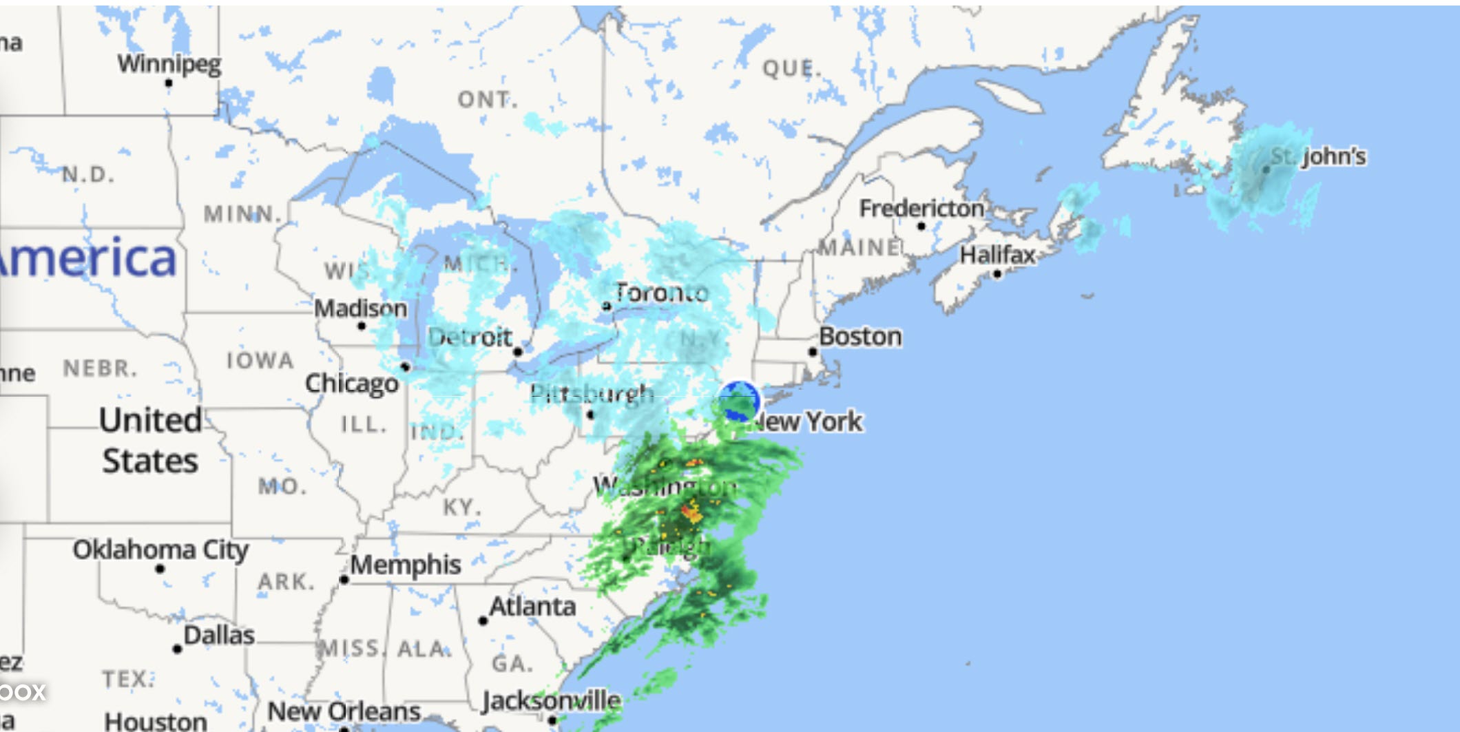
All the forecasts say the rain will turn to full-on, heavy, wet, snow, around noon. Here is what the LIVE weather radar map is showing as of 7:40 AM EST:
Forecasters have been saying this patchy storm will undergo "Bombogenesis" and become a ferocious low pressure system, with winds at Hurricane force, later today into tonight. The worst snow, they say, will come overnight tonight into Monday.
Forecast pressure now down to 969mb.
Cat 2 / 3 Hurricane Intensity.
Just off the coast.
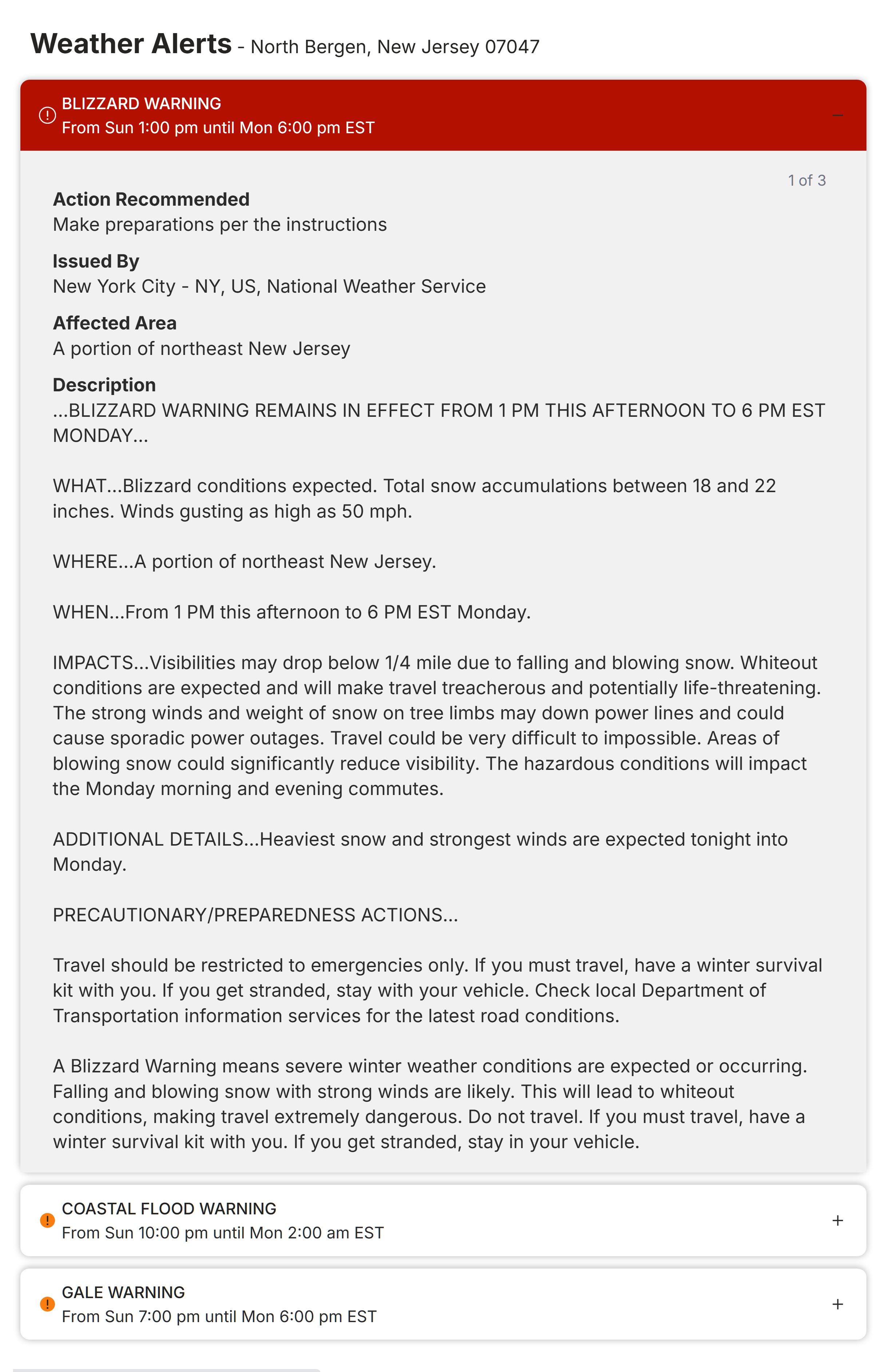
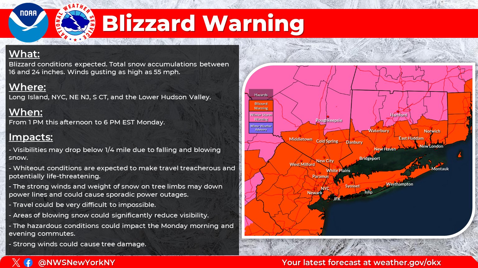
Here is the updated BLIZZARD WARNING (Conditions to commence around 1:00 PM today) from the National Weather Service:
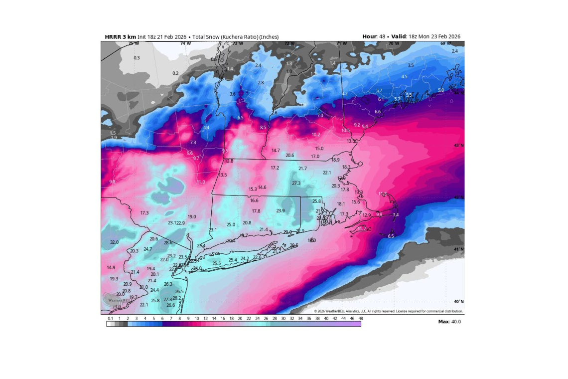
Yesterday's Blizzard Warning forecast snowfall totals 12-18 inches. Today's update says 18 to 22 inches! Worse!
I've done all I know how to do so as to try to prepare for this thing. Now it's just a matter of hunkering down until I have to go out and snowplow. That ought to be quite an experience.
More later.
UPDATE 8:34 AM EST --
National Weather Service now upping snowfall forecast AGAIN: 24"
UPDATE 10:29 AM EST -- The rain has changed to snow here in the last very few minutes.
It . . . has begun. . .