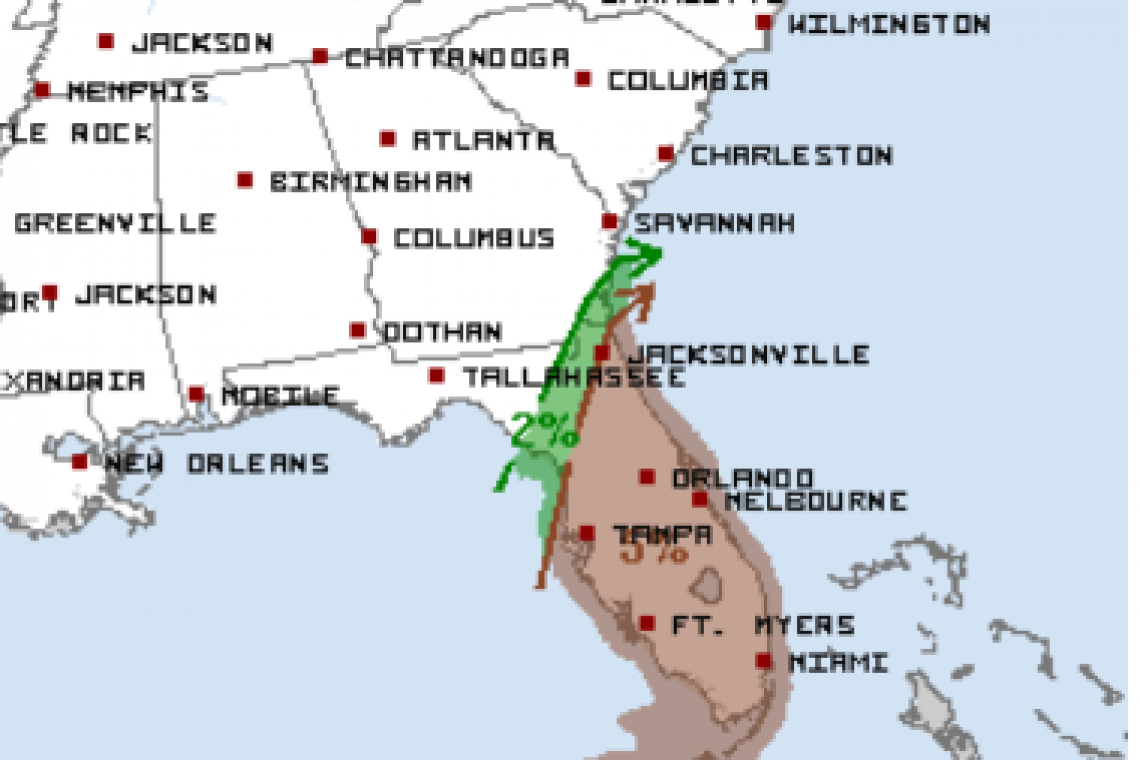
A SEVERE WIND and TORNADO threat exists for Florida tonight (Saturday) and early morning tomorrow (Sunday). Some pretty stout parameters forecast by guidance for this threat under low instability but its enough.
Storm Prediction Center (SPC) is still showing only "slight" risk, but the area on Saturday is now twice as big as yesterday (Friday).
As low moves up east coast tomorrow (Sunday) the morning threat will likely include southeast GA then the Outer Banks of North Carolina depending on the low track.
One track that is offshore limits most of that threat, however an inland track puts these areas in the tornado and severe wind chances tomorrow (Sunday).
As confidence increases the outlooks may change during the day/evening so be ready for that.


