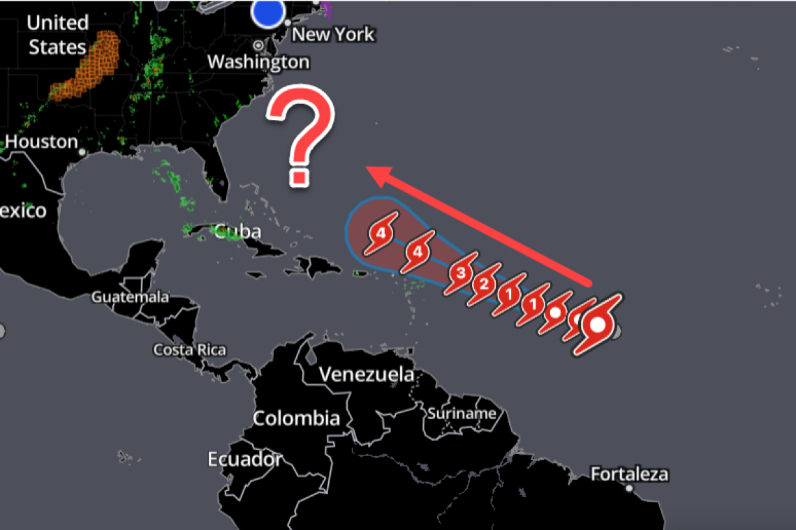
The National Hurricane Center is tracking a Tropical Storm out in the far Atlantic, headed toward the U.S. Mainland. Right now, it's a big nothing, but Forecasters are saying it **WILL** become a Category 4 Major Hurricane.
Just a cautionary heads-up to all readers in the U.S. to maybe pay some attention to this to see where it heads. It __may__ turn due north, stay out at sea, and affect nothing. But, it may not.
GFS computer model has landfall in Nova Scotia, CANADA, on 09/14/2023 11pm as Cat 3.
If it tracks a few degrees more west, it could hit any where from Long Island to Maine.
Any forecast beyond 4-5 days is likely to change particularly with that angle of approach.
Everyone on the E coast should monitor this storm if it becomes a Cat. 3 or higher.
Prudence dictates we give this a glance once a day to see where it's heading.