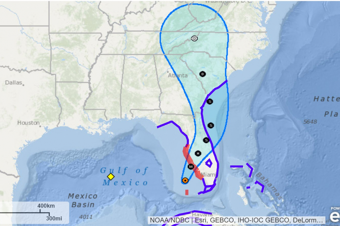
Hurricane Ian in the Gulf of Mexico will make landfall shortly after 2:00 PM today, north of Cape Coral, Fl, with maximum sustained winds of one-hundred-forty (140) miles per hour. The storm will then make a beeline up toward Orlando, cross out into the Atlantic Ocean and head toward Savannah, GA and Charleston, SC.
Persons on the Gulf Coast of Florida, between Chokoloskee and Palm Harbor, including Sarasota and Tampa, are under Hurricane Warning from the National Hurricane Center.
Not only are winds expected to be about 140 MPH at landfall, rain up to TWO FEET is expected to utterly drench the area as the storm comes ashore. Worse, "storm surge" where Gulf water is literally pushed by the non-stop winds, are expected to reach fifteen (15) feet as the storm comes ashore. This means, wherever the tide would normally halt on any given day, people in that area can expect it will be fifteen feet higher.
That storm surge will knock houses off their foundations, killing everyone foolish enough to stay.
If you are under an EVACUATION ORDER from local authorities, you should get out immediately.
If you are foolish enough to stay, please use a black magic marker to write your Social Security number along your forearm so authorities can more easily identify your dead body when they find it after the storm.


