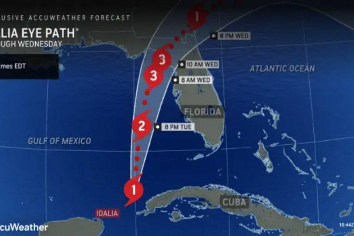
Tropical Storm Idalia has officially become a Hurricane and is heading for landfall tonight-into-Wednesday, with "explosive strengthening" expected before landfall north of Tampa, Florida.
Meteorologists are concerned that this system could strengthen rapidly up until the point of landfall as it moves across an area of very high ocean temperatures in the Gulf," said Buckingham. "This will pose an extra risk to Florida since preparations for an intense hurricane may need to be completed very quickly."
Rapid intensification of a tropical cyclone is defined as an increase in maximum sustained winds of at least 35 mph (55 km/h) in a period of 24 hours or less, according to the National Hurricane Center.
Storm surge is also a major concern as the intensifying tropical system nears the Gulf Coast of Florida. The winds surrounding Idalia will push water into the eastern- and southern-facing beaches for several days, allowing water to build up over time. A storm surge of at least 3-6 feet may be possible from Ochlockonee Bay, Florida, in the eastern panhandle, to Port Charlotte.
It’s not out of the question that some portions of Tampa Bay could have a storm surge of 7 or 8 feet, according to AccuWeather Lead Hurricane Expert Dan Kottlowski. The greatest storm surge, perhaps as high as 10-15 feet, is expected near and just to the east of Idalia’s landfall.
Storm Surge is the additional water, PUSHED BY THE WIND, that comes in ON TOP OF normal tide levels. So whatever the normal tide would have been when the storm makes landfall, try to imagine 10-15 feet HIGHER levels, coming ashore. It is like a wall of water surging inland; knocking buildings off their foundations as it moves in.
People in the area who are told to evacuate should do so without hesitation.