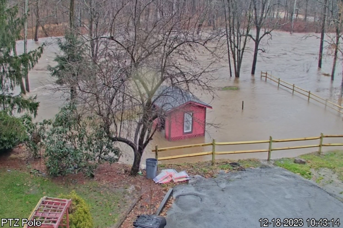
The Nor'easter that began striking the northeast USA yesterday, has dumped so much rain on my house in northeastern Pennsylvania, that the entire 1/2 acre of the property's lower level, is now flooded by the creek.
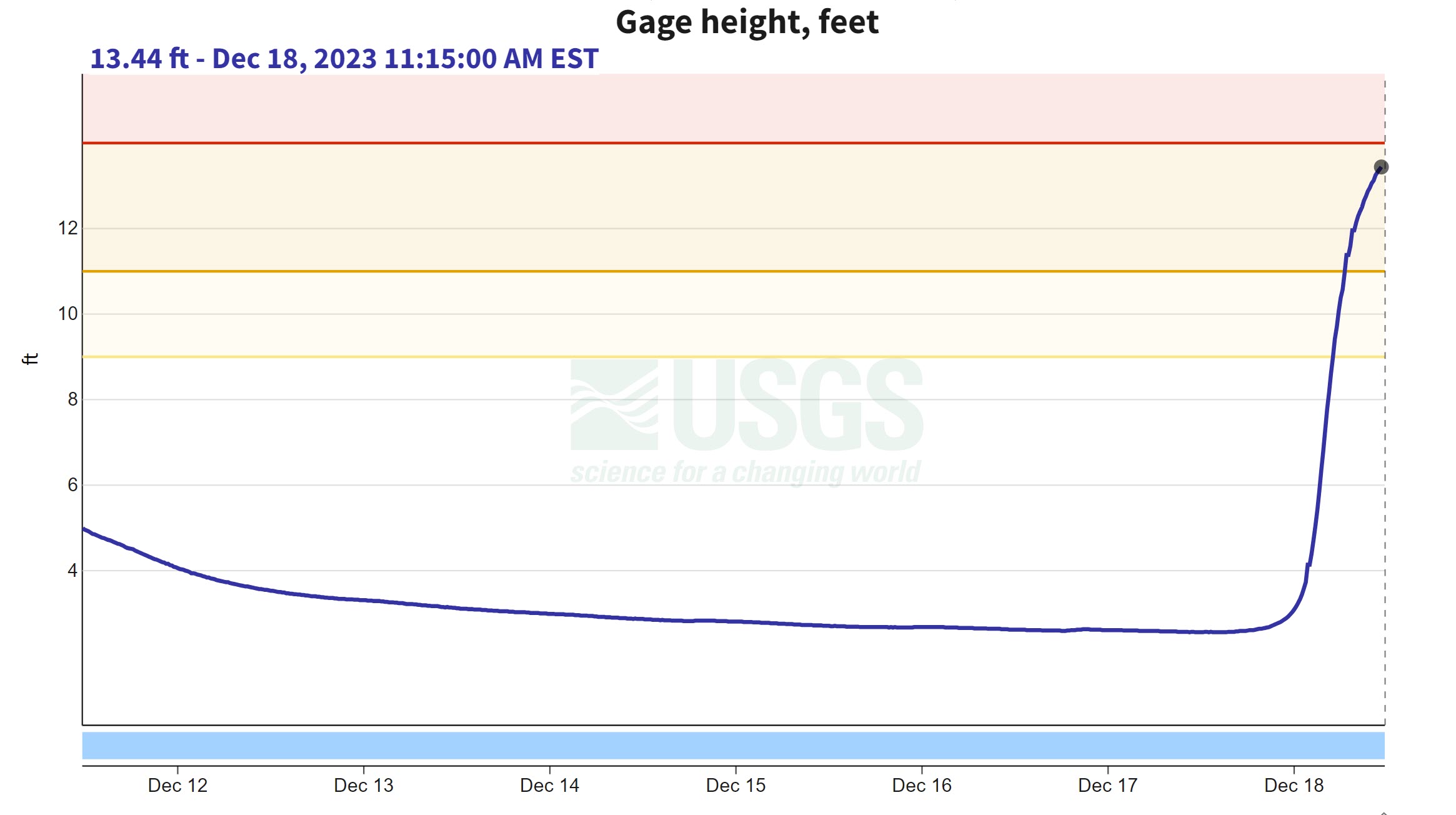
Yesterday morning at 10:45 AM, the official water gauge for the creek showed it's depth at only 2.57 feet. THIS morning at the same time, just 24 hours later, the gauge shows the creek at 13.12 feet depth. When the depth rose to 11 feet, the water began impinging on my lower level. At 12 feet, much of the lower level was flooded. at 13 feet, all of that level is flooded.
Now, the house is still well above that lower level and in the forty years+ that my family has owned that land, the house has never been impacted by flood waters. This time, who knows.
UPDATE 11:43 AM EDT --
The creek continues to rise. USGS water gauge now showing the creek at depth of 13.44 Feet . . . and rising:
UPDATE 12:57 PM EDT --
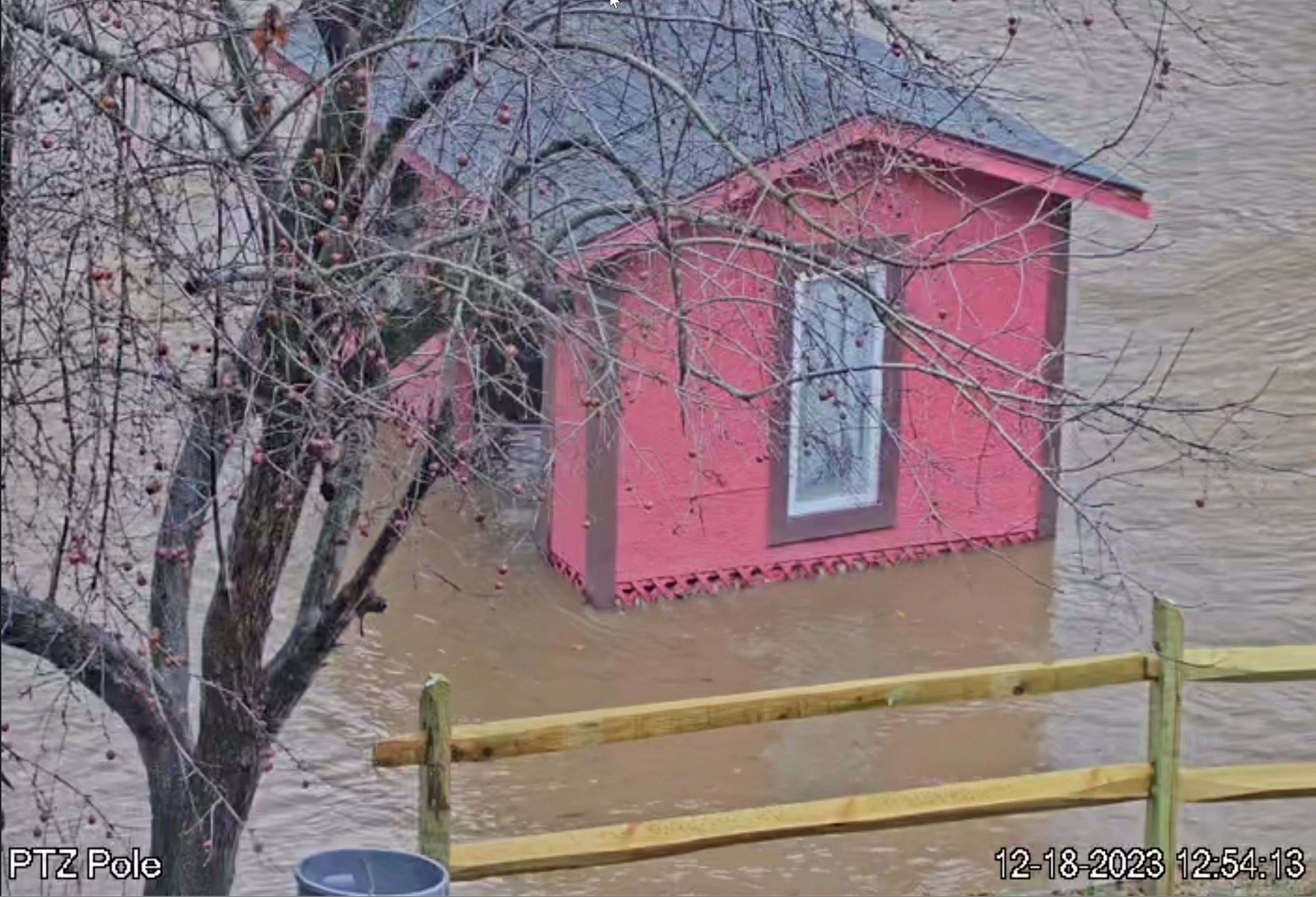
The water continues to rise on my property's lower level. The red storage shed down there is already flooded and the water is still rising. Around the perimeter walls of that shed, we long ago cut-out the plywood and installed lattice, to allow flood water to flow THROUGH the shed. The lattice extends two feet or so above ground level and as seen below, the water is almost to the top row of holes in that lattice.

The National Weather Service confirms the creek is at a depth of 13.7 feet and is expected to crest A FOOT HIGHER at 14.77 feet later this afternoon. That's another foot of water into the shed!
Once it gets above the lattice, there is a real chance the shed will be carried away by the water.
And if the shed let's go, it will likely take out a portion of the brand new split rail fencing nearby.
ARRRRRGGGGGHHHHHHHH!
UPDATE 4:37 PM EDT --
The water is RECEDING! ! ! ! ! There has been a very significant drop in the water level. The flooding never made it to even the foundation of the actual house. A neighbor stopped by a fe whours ago, when the water seemed to be at its peak, and there was still four feet vertically and five feet horizontally the water would have had to rise, to impinge upon the structure of the house itself. That did not happen. Also, the red shed remained in-place; did not float away or collapse. All-in-All, disaster averted. Thank you, God, Amen.


