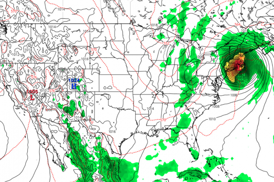
Computer weather models for Hurricane Lee are . . . ahem . . . changing. The latest ECMWF shows Long Island, NY being hit at its eastern tip, with strong effects on NYC and New Jersey, next Friday, before it crosses Long Island Sound and slams into Rhode Island, Connecticut, and on up into Massachusetts.
Here is the latest forecast map using the ECMWF weather model from the National Weather Service, showing landfall this coming Friday, September 15, as described above.

Of course, computer models can be wrong. Things can and will change between now and next Friday.
But they could change for the worse, the way they did for Hurricane Sandy, which was traveling north along the US east coast and suddenly, made a sharp left turn into New Jersey and brought havoc to my home state and to New York City. Flooded subways, flooded road tunnels and more . . .
Seems to me it happened once . . . it can happen again.
Start preparing just in case . . . .


