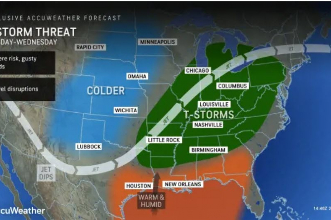
A volatile weather pattern is evolving for much of the country next week, bringing damaging thunderstorms and gusty winds from the Plains to the Eastern Seaboard, forecasters said Saturday.
The surge of Arctic air is expected to bulldoze the record-setting, May-like temperatures experienced in recent days, warned Guy Pearson, Senior Director of AccuWeather for Business and Weather Warning Operations.
"It's a matter of how everything comes together in the atmosphere," Pearson explained. "We have all kinds of energy and moisture to work with, but the question is if all the pieces come together just right to define a large severe weather outbreak or not."
AccuWeather experts expect potent thunderstorms to develop late Tuesday and continue through Tuesday night across part of the Central states.
TUESDAY
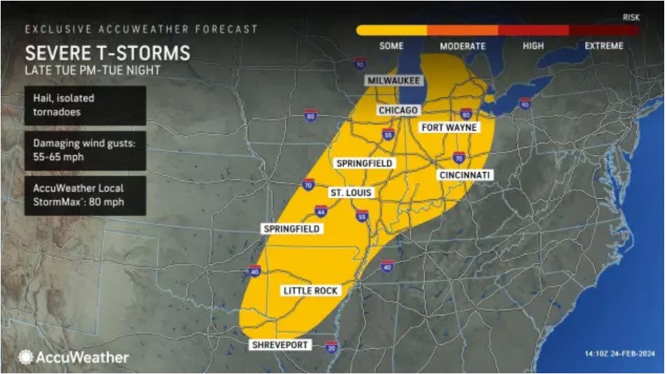
"With the building warmth ahead of this storm, the threat for severe storms could be unusually far north by late-February standards -- and possibly extend all the way into Lower Michigan. Cities as far north as Detroit, Chicago and Indianapolis could all be threatened by severe storms that can bring downpours, hail, damaging winds and even an isolated tornado," AccuWeather Senior Meteorologist Dan Pydynowski said.
The expected forward speed of the storm has trended faster compared to a few days ago, which will result in downpours and potentially severe thunderstorms progressing into the Eastern states by the middle of the week.
WEDNESDAY
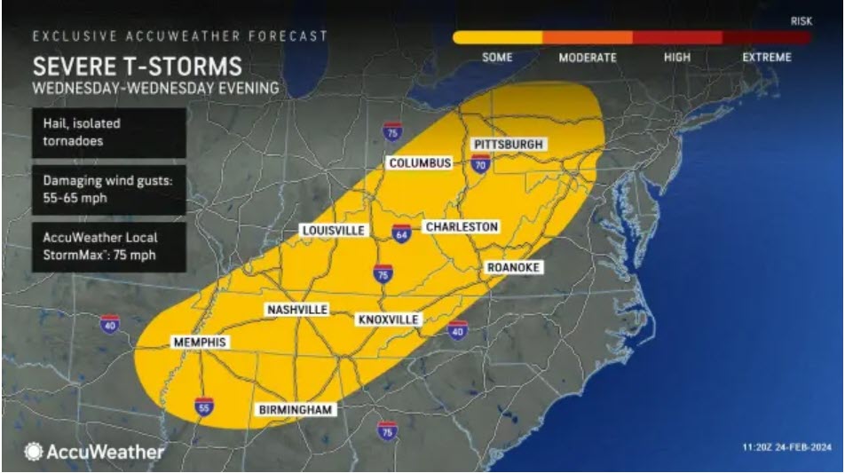
"On Wednesday, the rapid press of cold air is likely to undercut the severe weather threat as thunderstorms approach the Appalachians. However, there is the potential for some severe weather to affect areas from Pennsylvania to portions of Mississippi and Alabama, as well as part of northern Georgia," AccuWeather Senior Meteorologist Alex Sosnowski said.
The threat of severe thunderstorms may begin to wane as the front moves toward the Eastern Seaboard later Wednesday into Wednesday night, but hazardous weather can still impact the corridor from Boston to Washington, D.C.