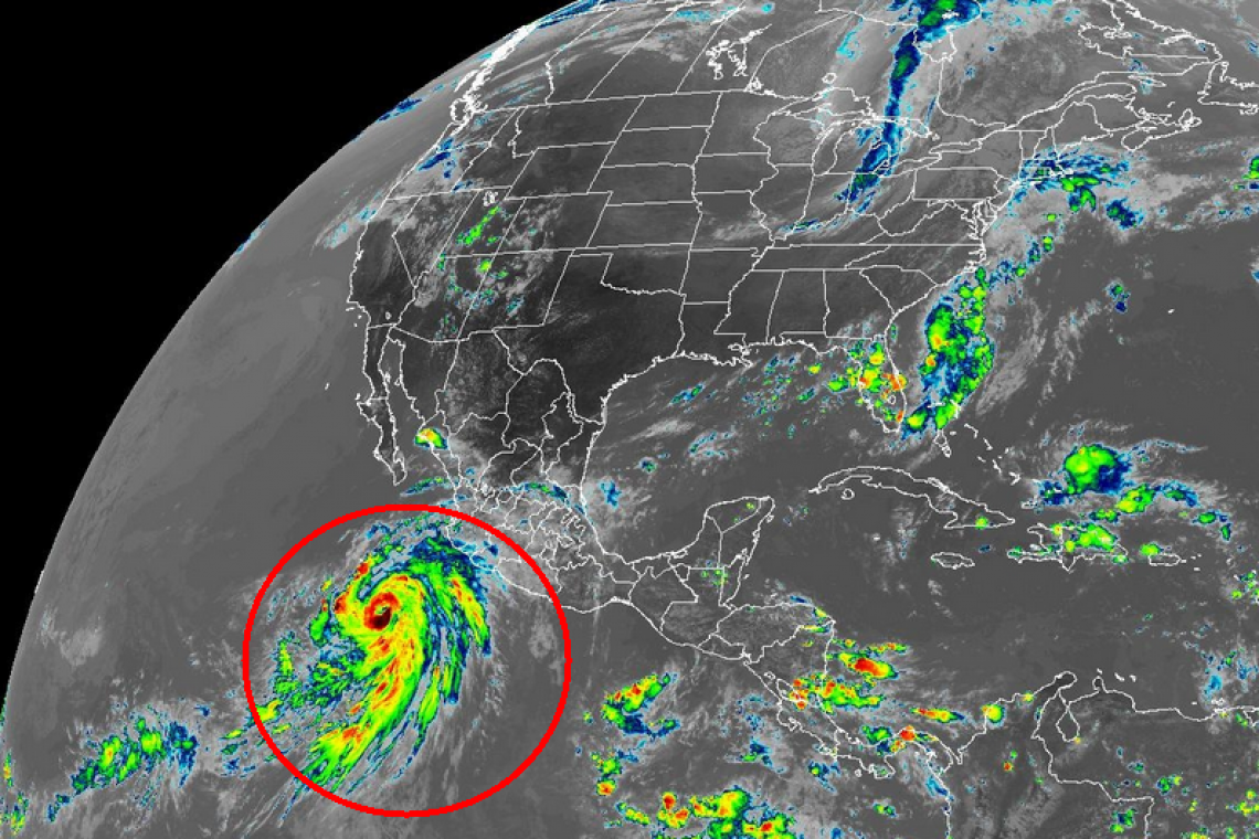
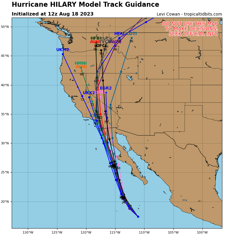
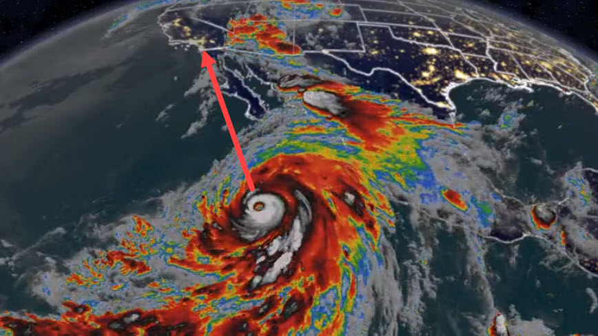
The National Hurricane Center says Pacific Ocean Hurricane "Hillary" is headed for southern California; expected to come ashore near San Diego and move rapidly toward Los Angeles. The storm is now a "major" Category 3, with 120+ MPH winds and over 600 miles wide. A storm of this size has not hit California in 84 Years. No one alive there knows what a Hurricane is like: Deadly.
Computer Models show the potential track of the storm:
Since no one alive in California has __ever__ lived through something like this, let me try to describe it.
When you were a child, many of you at some point stuck your hand out the car window while your Dad was driving and felt the wind as he drove 60 MPH down the highway. Try to imagine the wind being DOUBLE . . . and not stopping. Not even pausing.
Hurricanes come ashore with what's called "Maximum SUSTAINED Winds." The winds don't stop. There's no break in them. They come in at 120 MPH and they just keep blowing at that speed for a couple HOURS.
Roofs come off houses, apartment buildings, warehouses and factories. And when the roofs come off, the walls all collapse.
Trees get ripped right out of the ground and hurled like several ton toothpicks, smashing and wrecking everything they hit.
Cars, truck, buses, get flipped over.
Electric power lines get ripped off poles. Transformers explode.
Then, there's the rain. Not like regular rain or even a thunderstorm. This rain is TORRENTIAL. Rainfall amounts in San Diego, Los Angeles and inland are already being forecast at TEN INCHES in less than a day. The flooding happens so fast,. and over such an area, it is incomprehensible.
Worst of all is the "storm surge" that comes in just before and along with the landfall of the "eye" of the hurricane.
Along the shoreline, the circulating pattern of the winds literally PUSHES ocean water. As the storm approaches the coastline, its winds are pushing so much water the water piles-up on itself as it comes ashore. People along the shoreline will see the water suddenly begin to rise, and rise and rise, then break the coastline and come inland.
The water rises within SECONDS. Vehicles driving along Pacific Coast Highway or some similar coastal road will see mere wet roads one minutes, then find themselves completely inundated a minute later with surging sea water, that gets three, four-five FEET deep within about 90 seconds. Vehicles are carried away by the angry surging water.
Buildings along the shoreline are hit with this surge and they knocked right off their foundations and collapse.
Those structures which do no immediately collapse are hit with more and more sea water. And atop that flooding, are the normal, typical ocean waves that repeatedly slam into the structures, weakening them with every wave.
At some point, the walls simply cannot remain standing and they collapse. The ocean water rushes inside, causing the other walls to collapse. People inside are carried away by the water, screaming in terror as they drown, in ocean water that does not care one wit it is killing them.
THAT is a Hurricane. THAT is what San Diego, Los Angeles and other areas are likely to be hit with, starting ONE DAY FROM NOW.
If local authorities tell you to evacuate - do it. Don't think "Oh, it's just a lot of wind and rain." It's not that simple - at all.
If you get caught in the storm as it makes landfall, you will be lucky to survive.
Those of you who are told to evacuate but refuse, take a permanent magic marker and write your social security number on your forearm so authorities can identify your dead body when they find it.
Those of you not in the path of the "eye" can expect long-term, widespread, electric power outages for, perhaps, WEEKS.
Be prepared with emergency food, water, medicines you need to live on. Have an electric generator and some fuel to run it. But DO NOT run a generator inside your home, carbon monoxide gas from the motor will KILL You. DO NOT store gasoline or other fuel inside your house, it can explode.
Have a way to cook when utilities are out. A barbeque grill or propane grill.
Have flashlights for each member of your household, with spare batteries for each.
Have a portable radio with spare batteries for local news and info.
Gas-up your car(s) and be ready to haul-ass if you are told to evacuate.
DON'T WAIT to make these preparations because all the other people around you, will be forced to do these things too, and store shelves will be emptied of food. Gas stations will RUN OUT of fuel.
Prepare TODAY. Not tomorrow. TODAY. Those who wait, will find themselves able to get . . . NOTHING.
YOU HAVE ONLY ONE DAY TO PREPARE.
UPDATE 10:27 AM EDT --
Hurricane Hillary has increased in strength and is now, officially, a "Category 4" major hurricane, with sustained winds of 145 mph


